
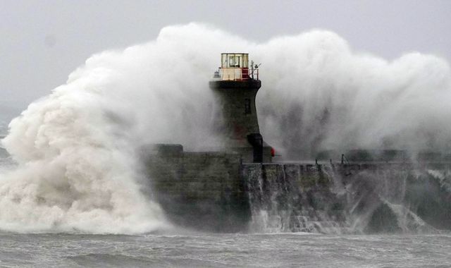
The second named storm of the season is set to hit the UK on Saturday, the Met Office has said.
Storm Boelo is expected to mostly affect northern parts of the country over the weekend.
Forecasters say the strongest winds will be across Northern Ireland, Scotland and northern England on Saturday.
Boelo's arrival comes less than 48 hours after the announcement of the first named storm, Austen, which is set to hit on Friday, with southwest England bearing the brunt of its northwesterly winds.
The Met Office has issued one amber and two yellow wind warnings for Austen covering the whole of Cornwall, the Isles of Scilly and parts of west Devon.
When Boelo hits, it will bring "impactful winds" to northern parts on Saturday night and through Sunday, the agency warned.
It will arrive in Northern Ireland and western Scotland on Saturday afternoon, having been "invigorated by an active jet stream as it crosses the Atlantic".
The whole of the UK can expect heavy rain on Saturday, as the storm moves in from the West and wind strength builds through the day.
A yellow warning for wind has been issued for the whole of mainland Scotland, the Western Isles, Orkney and the far north of England from 6pm Saturday to 9pm the following day.
Widespread gusts of 55-65mph (88-105kph) are forecast, with more exposed coastal regions facing wind speeds of 70-80mph (113-129kph).
A separate yellow warning for wind has been issued for Northern Ireland from 6pm on Saturday to 3pm on Sunday, warning of 50-60mph (80-97kph) gusts widely, with up to 65-75mph (105-121kph) in exposed parts.
Met Office Deputy Chief Forecaster Chris Bulmer, said Storm Boelo will affect "the opposite end of the country to Storm Austen", as strong winds and heavy rain create "an impactful weekend of weather".
As Storm Austen approaches, the agency has updated its severe weather warnings.
An amber severe weather warning for wind now begins at 1am on Friday morning, while a wider yellow warning area has been expanded to cover western Wales and ends later, at 5pm.
A new yellow warning for wind has also been issued for a large area of England and Wales, running from 10am to 9pm, with gusts of up to 45-55mph (72-89kph) across the area.
More on Sky News:
Websites down worldwide - latest
Brand encouraged fans to come to dressing room for sex, rape trial hears
Met Office Chief Forecaster Neil Armstrong, said Storm Austen is bringing "the first stormy weather in the south of the UK this season and we expect some disruption as it moves through.
"With trees in leaf, it is likely fallen branches and trees could obstruct roads and railways so take extra care on the Friday morning commute."
Mr Armstrong predicted "large waves and dangerous conditions around the coast of Wales and southwest England", urging people to "stay away from cliff edges and well back from stormy seas that can sweep you off your feet".
Storm Austen clears into the North Sea by Friday evening.

(c) Sky News 2026: Boelo: Met Office names second storm to hit UK in 24 hours
 Government launches new push to prepare UK for emergencies and hostile acts
 Police Scotland to close stretch of A8 near Edinburgh Airport as investigation into fatal crash continues
 France reports first Shamonda virus case in human who later died
 1800s law must be updated to protect 'backbone' of UK, MP says
 Barclays cutting 5,000 jobs in AI-led efficiency drive
 North Korea plans to resume propaganda broadcasts along border with South Korea
 Offenders who refuse to attend sentencing will face new penalties under government plan
 Three more arrests over Nottingham police officer shooting